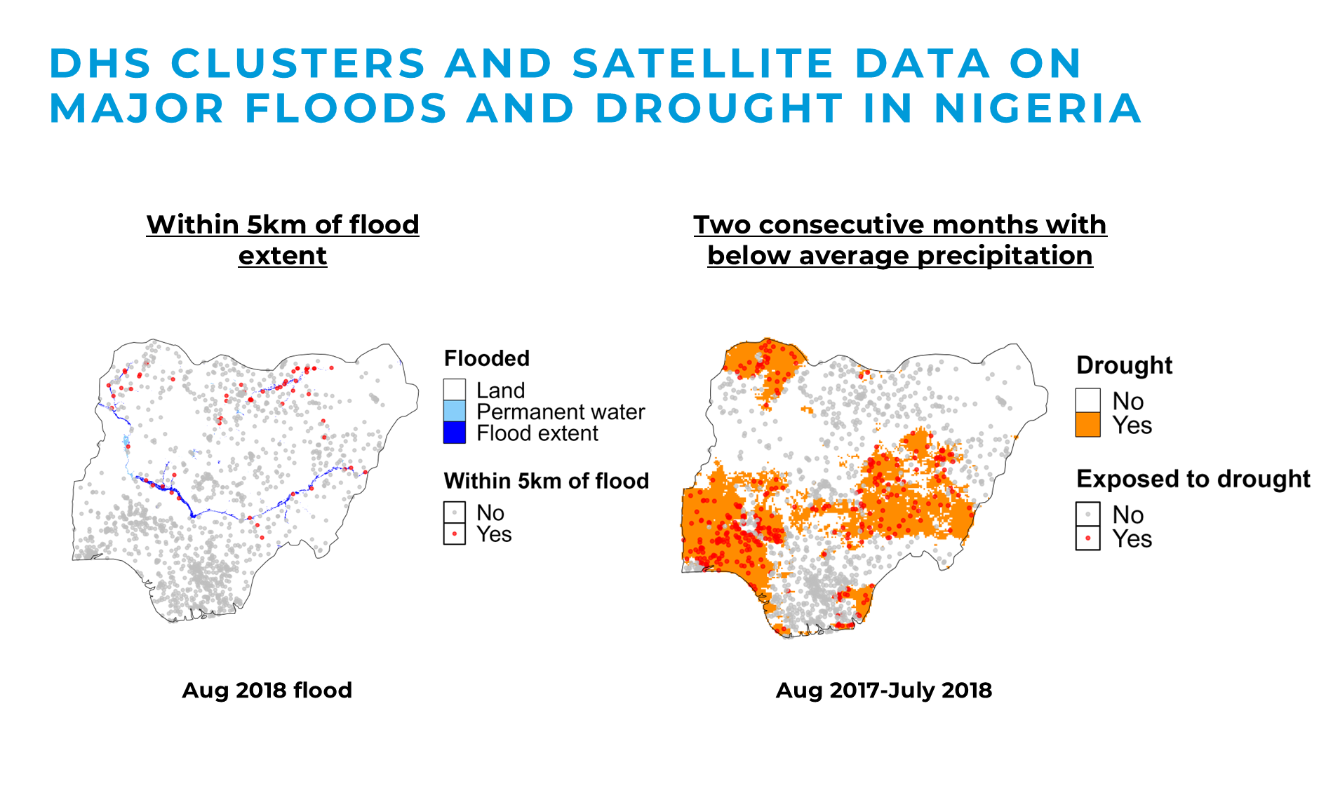
Quantifying child climate risk and resilience across Africa
I have been leading the integration of nationally representative child development data (MICS & DHS), with gridded population counts (WorldPop), and satellite-based climate observations (Google Earth Engine) to generate subnational estimates of the number of children exposed to floods, droughts, and heatwaves, as well as those who simultaneously lack access to improved water and sanitation, are undernourished, and unvaccinated.